

Solution
Workforce
Industry
Facility Management & Maintenance
Location
Asia


Overview
How a Leading Asian City Transformed Urban Cleanliness
When a city is consistently ranked among the cleanest in the world, the bar for keeping it that way could not be higher. In a major Asian metropolis, this responsibility falls on a local government agency tasked with overseeing cleaning contractors and ensuring that every street, drain, and sidewalk meets rigorous standards.
Behind the scenes, the agency’s Inspection Division deploys dozens of inspectors who patrol the city daily. Their mission is simple but complex: verify that contracted cleaning providers deliver on their commitments, while also reacting to sudden priorities such as dengue clusters, major public events, or even unexpected weather. Until recently, however, inspection planning was handled manually by individual planners, making it difficult to maintain consistency across regions.
Challenges
The Inspection Planning Challenge: Fragmented Spreadsheets, Shifting Priorities, Missed Targets
Each region in the city used to create its own inspection plans manually, typically in spreadsheets that differed widely in structure and format. This lack of standardization made it difficult to consolidate information across the city and to ensure that inspection goals were consistently met.
Planners also faced the added difficulty of balancing long-term coverage targets, ensuring all routes were inspected within a cycle of a few quarters, with short-term priorities such as dengue clusters, high-traffic zones, or large public events. Frequent rainfall added another layer of complexity, often forcing last-minute changes and leaving inspections incomplete.
The result was a process that was time-consuming, variable, and heavily dependent on the personal experience of individual planners. The agency needed a unified, data-driven way to improve efficiency, reliability, and transparency.
Solution
Turning Data Into Daily Action: A solution for Smart, Secure Inspection Scheduling
To address this challenge, the agency partnered with DecisionBrain and with a local leading IT consulting company, to design a cloud-based planning solution built specifically for the government’s secure environment.
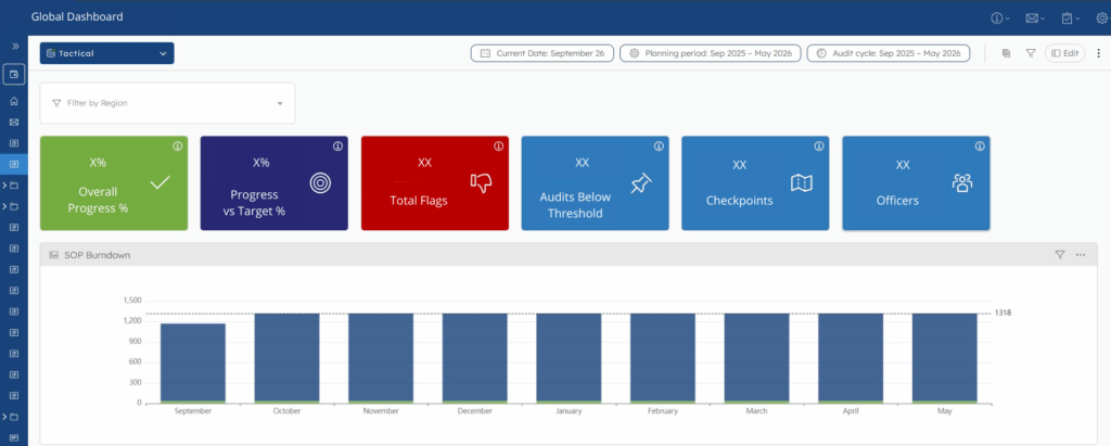
Global Dashboard
The system is fully integrated with the agency’s execution platform: inspectors use their own system to record completed tasks in real time, while street cleaning operators log cleaning results on tablets through a separate system that is connected to our application. These operational inputs provide the planning engine to continuously update both strategic and monthly operational plans, dynamically rearranging schedules as progress is tracked and unforeseen events occur.
At its core, the platform uses advanced optimization techniques (MILP – mixed-integer linear programming), predictive machine learning, and a sophisticated business rules engine. This ensures that:
- Every route across the city is inspected at least once in the defined cycle;
- Dengue cluster zones or event areas are prioritized immediately and inspected with high frequency;
- High-traffic districts receive more attention than quieter neighborhoods;
- Rainfall disruptions no longer derail operations, schedules are recalculated dynamically to catch up on missed inspections.
In addition to long-term strategic planning (spanning a few quarters), the platform also generates tactical monthly plans that break inspections down day by day. These plans automatically adjust in response to unforeseen events, such as rain or sudden emergencies, ensuring operations remain on track without interruption.
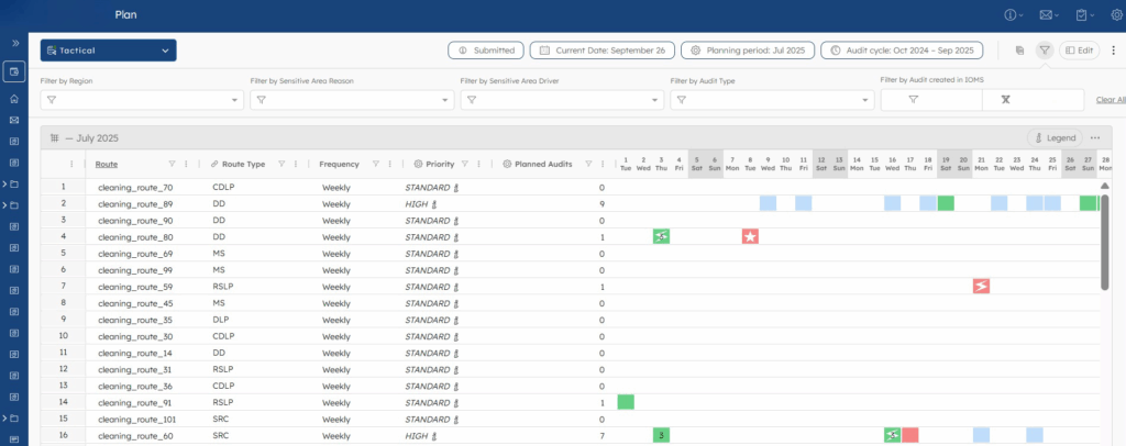
Monthly Plan
Just as importantly, we created a user interface designed to look and feel like the Excel sheets and reports inspectors were already familiar with, making adoption seamless while embedding cutting-edge intelligence behind the scenes.
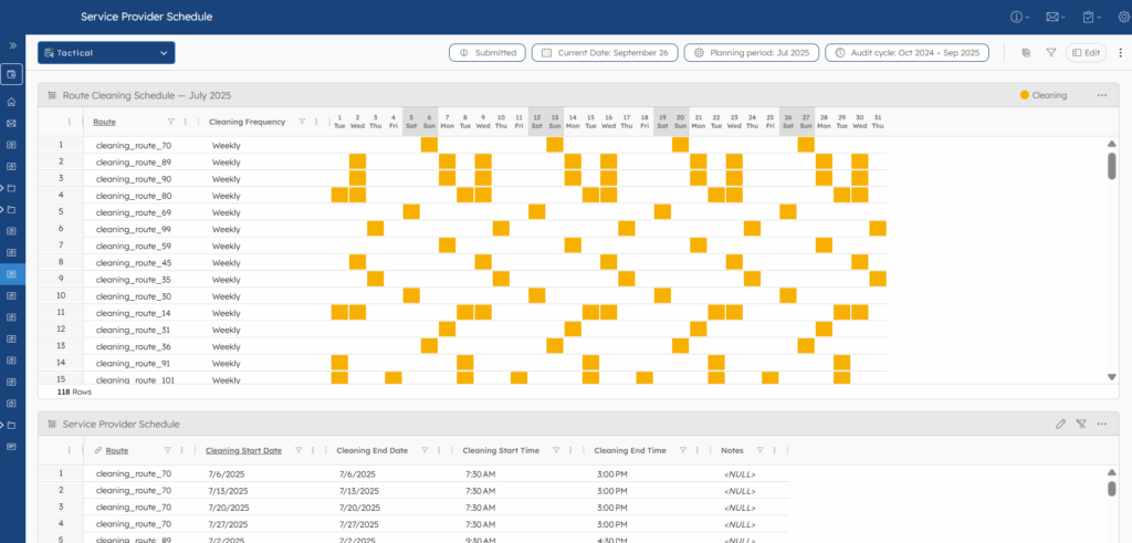
Service Provider Schedule
Results
From Fragmented to Unified: A Single System of Record for City Cleanliness
The impact was immediate. What had once been fragmented, manual, and dependent on individual know-how became a unified system of record and action. Inspectors now follow plans that are transparent, consistent, and fair, while managers gain full oversight across the entire city.
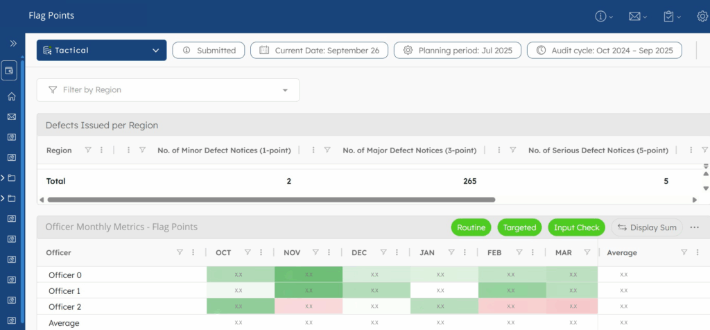
The new system not only streamlines planning and execution, it also provides the agency with full visibility of performance through a comprehensive set of dashboards and KPIs. Managers can now monitor results in real time, ensuring that strategic goals are aligned with day-to-day operations. Key dashboards include:
- Global Dashboard: city-wide view of progress and key results, highlighting completed work, risks, and areas needing attention;
- Performance Tracker: summary of individual contributions and alerts on potential issues;
- Quality Tracking: shows where service standards may need improvement and extra oversight;
- Regional Plans: tracks plan status to ensure timely reviews and better coordination.
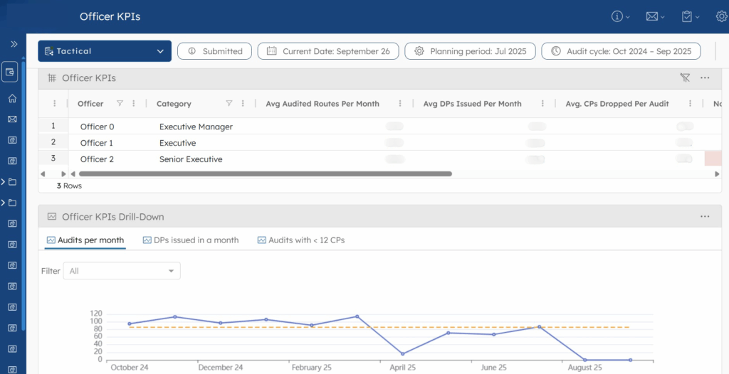
Performance Tracker
Flag Points
For continuous-flow operations
With these dashboards, leadership and supervisors gain unprecedented visibility over city-wide cleanliness. They can track progress at a glance, identify risks early, and take needed action quickly.
Beyond the operational wins, the project positioned the agency as a government leader in digital innovation. What was once seen as routine city cleaning is now powered by state-of-the-art optimization and AI.
Paving the Way for What’s Next
The success of this initiative has inspired the agency to explore new frontiers, planning the implementation of similar systems in other departments, thus reinforcing its global reputation not only as one of the cleanest cities, but also as one of the most forward-thinking in public health and urban management.
Want to learn more about our solutions? See how a facility management company reduced service cost for 10%-15%, and workforce productivity improved up to 20%.
FAQ
Our optimization is driven by Mixed-Integer Linear Programming (MILP), complemented by predictive machine learning for daily workload forecasting and business rules for defining the right priorities. The machine learning models are used to anticipate workload on a daily basis, while business rules guide the prioritization logic. The solver dynamically evaluates coverage constraints and operational capacities to build both strategic (multi-quarter) and tactical (daily/monthly) plans.
When a disruption occurs (e.g., heavy rainfall or flagged emergency zones), the engine automatically triggers a re-optimization cycle. This process recalculates inspection sequences and reallocates missed tasks efficiently, using geotagged locations for spatially aware rerouting without manual intervention.
The solution integrates all city regions into a unified planning engine using geospatial data layers. It calculates optimal coverage sequences based on travel distance, event geofences, and high-priority areas (e.g., dengue clusters), for balanced allocation.
Yes, the planning engine securely connects to the agency’s operational execution platforms through APIs. Data streams from mobile devices and parallel systems update the central database in near real-time, ensuring dashboards and plans reflect the current operational state.
The platform provides multiple KPI dashboards including:
- Global Dashboard: city-wide route coverage, completion rates, and missed inspections;
- Officer KPIs: inspector-level productivity metrics;
- Quality Views: cleaning lapse severity by region;
- Plan Tracking: submission, review, and approval statuses of inspection plans.
All dashboards are geospatially enabled, allowing managers to visualize and drill down by district or route.
The platform is deployed in a government-grade cloud environment, ensuring local data residency and security standards. It uses secure APIs, role-based access control, and encrypted data streams, and a scalable architecture for smart city initiatives.
Our platform’s core technology is powered by Mixed-Integer Linear Programming (MILP), machine learning forecasting, and geospatial planning and is adaptable to a wide range of urban services. It can be used to optimize daily and monthly operational plans, allocate resources efficiently, and respond dynamically to disruptions.
For example, city agencies can apply it to pest control programs, park and garden maintenance, road inspections, or public safety operations such as sobriety checkpoints and patrol scheduling. By combining geospatial data, predictive modeling, and real-time operational inputs, the system helps governments:
- Prioritize critical service areas;
- Minimize travel and response time;
- Improve coverage and citizen service levels;
- Scale operations without increasing manual planning efforts.
This flexibility makes the platform a strong enabler for smart city initiatives, supporting a wide range of essential public services with a single, integrated planning engine.
Other Customer Stories